This week I’ve been having fun riding around VA and WVA before and after meeting up with a friend in Roanoke. Here are the individual GPX Routes I created, feel free to download any or all of them:
Staunton VA to Hagerstown MD (I did this because I didnt have time to do Elkins to Hagerstown)
Elkins WV to Hagerstown MD (if you have more time than I did)
You might be wondering how I do my routing and directions on the fly while I’m on a trip like this. Because I refuse to bring a laptop for a 3-5 day trip. I do have my iPad sometimes but it’s not a laptop.
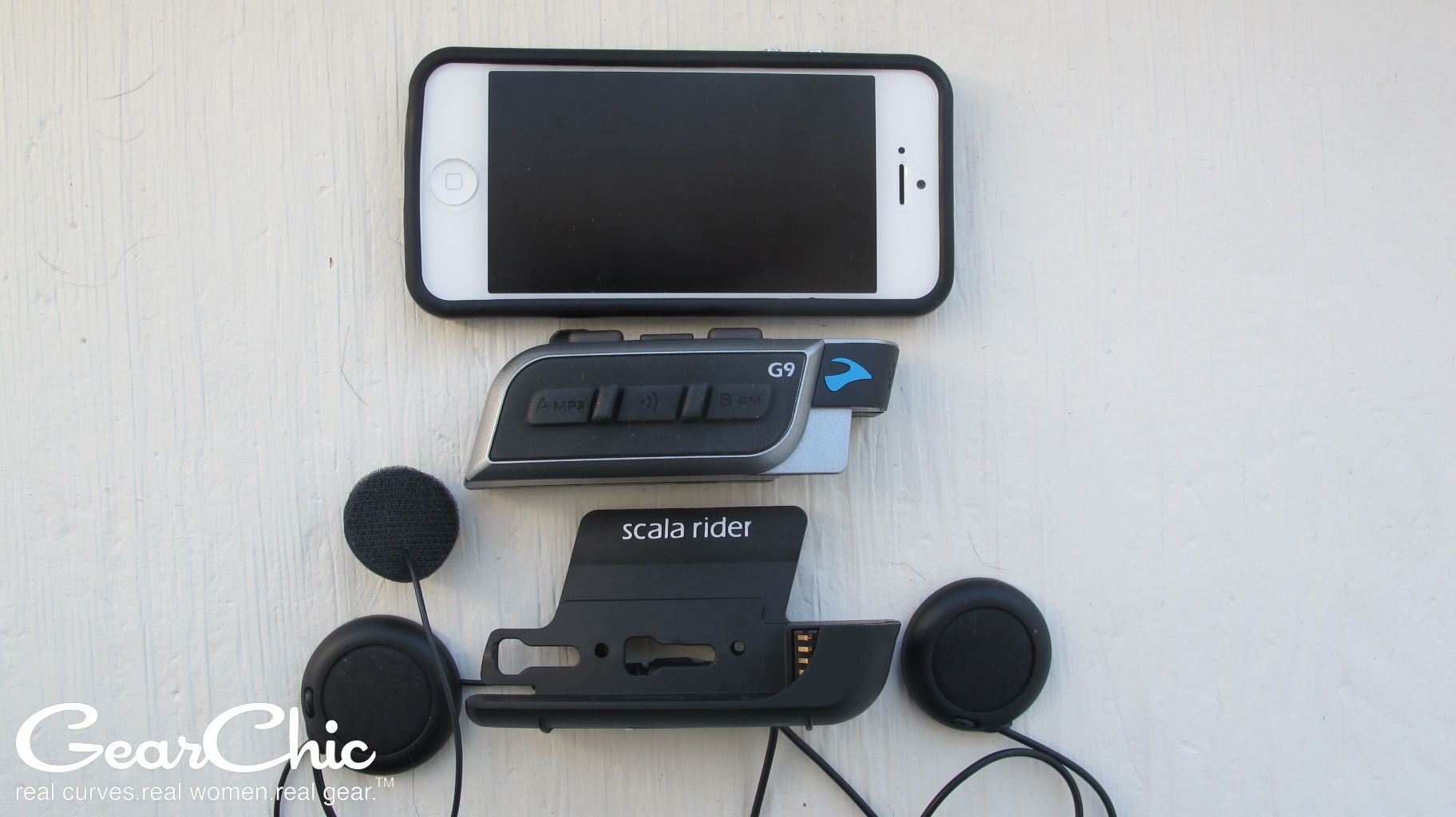
But when I’m out on a ride, or on a short trip, these are the 3 things I use: in conjunction with my iPhone so that I can do two very important things: A/ Create, save and/or share a route on my phone (without a computer) and B/ Receive turn by turn directions into my helmet.
Bluetooth Intercom (Sena or Cardo or Other). Right now, I’m using an older Sena SMH10R since my Sena 10R is on my Bell. But this Summer I’m going to spring for a new Cardo Freecom 4+ with JBL speakers. Woo hoo!
InRoute app (iPhone only) - Read my Review here which shows you how to make GPX routes on the fly, as well as exporting them to share with a friend, or saving them for later. This feature is what differentiates it from Google Maps. At least for those of us with iPhones. I’m guessing Android users might have more privileges, and if that’s the case please post a comment below.
As much as I like this app, the only thing I hate right now is the sound quality of the Voice. The female US English voice is too high pitched, so I started using the male UK English voice and it’s much better. I’m hoping that when I switch to Cardo, it’ll be a little better. The Google Maps voice (I call her Gigli) is much, much clearer and smoother.Google Maps: I mainly use this as a search tool for things like gas stations, restaurants, etc. Although you can create a multi-waypoint trip, you are limited to so many waypoints (far less than 100, I think 10ish or something) and you can’t save them on an iPhone. So InRoute really works better as a trip planning tool.
So I use #1 and #2 so that I can get turn by turn directions through to my helmet so I don’t have to look down to view the directions. I do have my phone mounted to a Ram Mount just in case, but I generally try not to look at it and just rely on the audio.
I created all of the above routes on my iPhone, using the InRoute app, no computers needed. You do have to pay a monthly or annual fee in order to have many waypoints but it’s worth the $30/year subscription for 100+ waypoints.
If you have any questions, please post a comment!
For more trip photos, please follow me: instagram.com/gearchic

